Subdivision mapping with a control network recovery
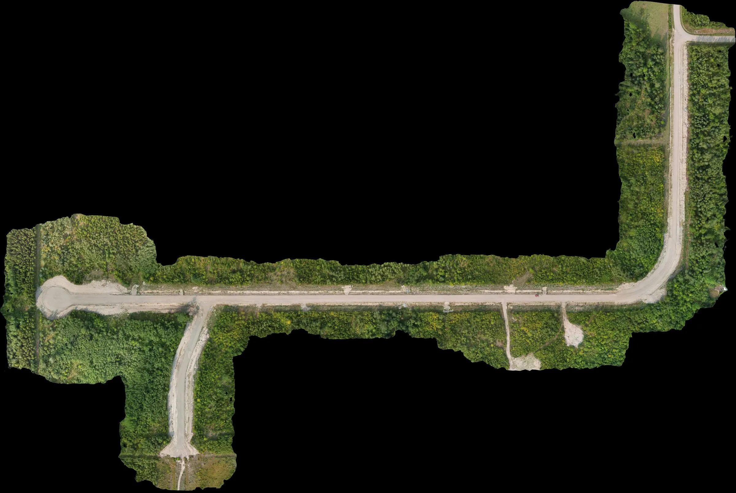
Subdivision topographic and ortho mapping with the added job of salvaging a compromised control network left over from a prior contractor. Mapped the site, then compared current conditions against the original design to estimate completion remaining.
- Client
- Confidential
- Area
- 12 ha
- Industry
- civil
The ask
Topographic and ortho mapping for an in-progress subdivision, with a design overlay for tracking outstanding work. Complicated by one thing — the control the previous contractor had set was bad. The fix-point they’d used was a rough navigation-grade fix, not a post-processed solution, and by the time I was on site that team was gone. The point was unusable as-is.
How I approached it
Walked the site first and found enough of the prior contractor’s existing control to work with. Re-observed those points with RTK corrections against my own Emlid Reach RS3 base running a static session. Pulled the raw observations into Trimble Business Center and ran a least-squares network adjustment — tied the old contractor’s control back to a real solution so their network wasn’t scrapped, then added new control across the subdivision where more coverage was needed.
Flew the whole subdivision, GCPs re-observed on pickup. Processed the imagery in Agisoft Metashape Pro against the adjusted network. Overlaid the processed surface against the original design in CAD and ran a comparison for the client to see what was still to be built vs what was already in the ground.
Deliverables
Orthomosaic, DSM, bare-earth DEM, classified LAS point cloud, a control adjustment report with the calibration and CSVs, and the existing-vs-design comparison sheet. Four files the client could hand to a project manager and get a real answer out of.
Outcome
The subdivision ended up with a defensible control network instead of a broken one, and a clear picture of how much work was actually remaining against the approved design. The salvage work on the control was the main value — starting from scratch would have cost the project a lot more than a day of least-squares adjustment.
Deliverables
- • Orthomosaic
- • Digital Surface Model
- • Bare-earth DEM
- • Classified LAS point cloud
- • Existing-vs-design comparison sheet
- • Control adjustment report (CSV + calibration)
Tech
- • DJI Mavic Air 2s
- • Emlid Reach RS3 (base + rover, static logging)
- • Trimble Business Center (least-squares network adjustment)
- • Agisoft Metashape Pro