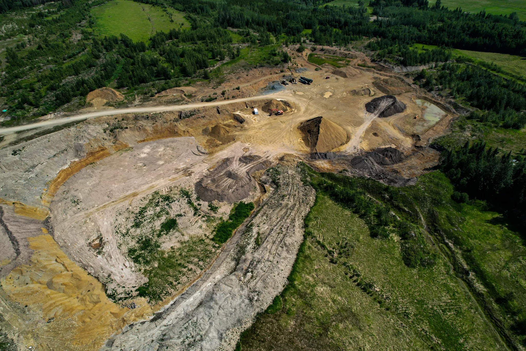
Topo update for an active aggregate pit
Refreshed the topographic surface of an active aggregate pit south of Prince George. Tied into the site's existing control so the new data dropped straight into the operator's design environment.
- Client
- Confidential
- Area
- 33 ha
- Industry
- mining
The ask
Update the operator’s pit topo. Their baseline was out of date and they needed a current surface to plan against.
How I approached it
Set up on the pit’s existing control monuments and ran a static logging session at the base for the full flight block. Walked the pit, set ground control across the floor and benches, and picked up the toes of the active piles on foot. Flew the site with the Mavic on planned lines. On pickup I re-observed every GCP so each control point had a second epoch before I broke down.
Into Agisoft Metashape Pro — bundle adjustment tied to the GCP network, classified point cloud, and ortho, DSM, and bare-earth DEM exported on the pit’s historic coordinate system (NAD83 UTM 10N / CGVD28 HT2 2002) so nothing had to be reprojected on the operator’s end.
Deliverables
Orthomosaic, DSM, bare-earth DEM, raw LAS point cloud, and a survey report covering control, accuracy, and processing notes. Full package delivered November 2023.
Outcome
Current pit surface replaced a stale baseline. The operator’s planning team picked it up and kept working — no CRS wrangling, no re-registration, just a fresh topo in the coordinate system they were already using.
Deliverables
- • Orthomosaic
- • Digital Surface Model
- • Bare-earth DEM
- • Classified LAS point cloud
- • Survey report
Tech
- • DJI Mavic Air 2s
- • Emlid Reach RS3 (base, static logging + rover)
- • Agisoft Metashape Pro